La Unión, Arequipa, Peru
Suggest Place to Visit
1370
Track to location with GPS |
 |
The district of Charcana belongs to the province of La Unión, capital Cotahuasi, Arequipa region, located to the west of the province, in front of the Solimana volcano of 6,117 meters above sea level, surrounded by the apus Caisampo 4,538snm, Santiago 5,069, Suramarca 4,163m; At an altitude of 3,417m, it refers to the capital of the same name, since its altitude at the district level ranges from 950 to 6,100m.
38 km. of distance in highway to Cotahuasi; which was inaugurated on June 21, 2006, with a surface area of 165.27km2; with a population diminished by the massive migration from l980, to the city of Lima and the USA. Currently there are 347 voters according to the existing roster in the municipality in 2006; calculating in 600 inhabitants, during the government of the president Pezet had 1,500 hbs.
It borders on the east with Pampamarca, on the west with Quechualla, on the north with Oyolo and Corculla (Paucar del Sara Sara) and on the south with Toro and Quechualla. It is interconnected by 5 bridle paths:
1.-Old road from the Wari era to Parinacochas (Ayacucho)
2.-Towards the south main road to Cotahuasi via Andamarca
3.-To Quechualla for Picha
4.-East of the old road to Cotahuasi via Cerquena, Mungui
5.-To the annex of Allancay, Velinga, Sipia Cotahuasi.
ETYMOLOGY OF THE WORD CHARCANA: More than one charcanino has written on the subject, and they simply affirm that the word CHARCANA comes from the word CHARQUINA because it was made beef jerky; nothing more false. We must locate ourselves in historical time and space, the names of the towns appear when the villages are formed; It was not born in the Incan (12th century) either; Furthermore, the Incas were vegetarians, they only ate smaller animals such as fish, partridge, guinea pig; This is confirmed by archaeologists TSUDE AND MEJIA XESSPE (from Toreño); Furthermore, the cow, sheep, and goat arrived in Peru after 1539, carried by the Spanish.
When referring to CHARCANA Felipe Paz Soldan says: ´´CHARCANA, it may be a corruption of CHARICCANA, which means in the Aymara dialect´´ ´´Old or old light´´.
When the viceroyalty was instituted in Peru in 1542; Encomiendas were established under the command of the encomenderos and Parinacochas and Charcana belonged to Gonzalo Pizarro. In 1569, the viceroy Lope Garcia de Castro divided into townships, divisions and curatos, and charcana as a priest was part of the bishopric of Cusco, says the viceroy Francisco de Toledo in the relation of the rate of visits made in 1572.
In 1609, the bishopric of Huamanga and Parinacochas was created as Charcana was incorporated into this bishopric. In the ecclesiastical by its size Parinacochas is divided in 2 Parties: Parinacochas and POMATAMBOS; and the curatos of Charcana, Corculla, Colta, Oyolo, Sayla, Pampamarca, Huaynacotas were integrated into Pomatambos. In 1784, the viceroy Teodoro Criox created the Municipalities, the Parties and the Curatos, in replacement of the corregimientos, and Charcana was a parish of the Parinacochas party and the Huamanga quartermaster until 1835. Charcana is a hacienda in the department of ayacucho, province of huamanga and district of Tambillos
Charcana, a town hidden in the heights of the Union, still preserves its ancestral uses and customs, Inca and colonial mix. The town of Charcana is located at an altitude of 3,417 meters above sea level. The capital of the District is called Charcana, a small and beautiful town that arises in the middle of gigantic snow-capped mountains, in the Andean part of the Cotahuasi Canyon. It has a privileged view of the snowy Solimana and Firura mountains. Its population is close to a thousand inhabitants.
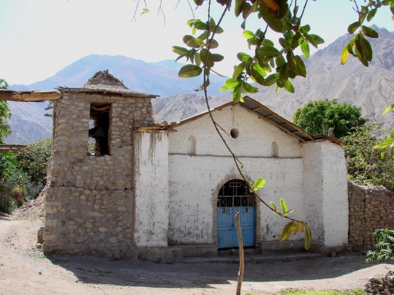
Arriving at Charcana is like arriving very close to the Olympus of the Apus, from this town you can see the Nevados Solimana and the distant Firura. Pisar Charcana is like traveling back in time to the end of the Inca period and the beginning of the colonial period in the Peruvian Andes, the small adobe and ichu chosas take us to the Inca and pre-Inca buildings and the viceroyalty style of the old mansions of adobe and tile with large and heavy doors with brass and steel knockers remind us of the splendor of the Viceroyalty.
Calm and colorful town, Charcana is the gateway to the Ande Unionense, in the circuit of its heights the Condor, the puma and the vicuñas travel at speed through the frigid pampas and punas of the Cotahuasi Canyon.
The village.-
The journey from the town of Charcana to Cotahuasi, the provincial capital, is made in three hours by a carriageway in rural vans type ´´combi´´. This distance until very recently was covered in 8 hours of strenuous travel on mule trails.
The town has a satellite phone No. 054 812121 054 812121
It is one of the most traditional towns in the province of La Unión. Most of the houses are made of adobe thatched with straw.
It has an excellent view of the snowy Solimana and Firura mountains. The Ccaysampo hill is the tutelary Apu of the town.
Colonial church.-
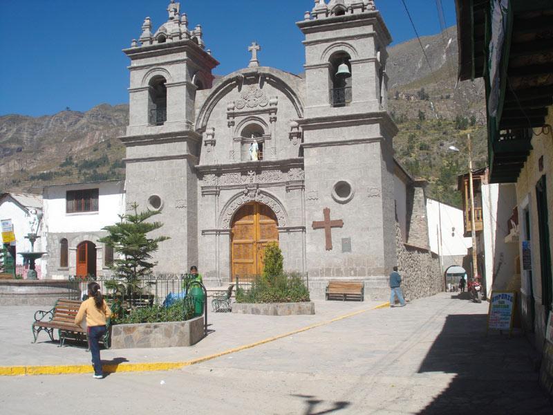
Former Colonia de San Sebastián Church. Refurbished in 1932.
Huancarama Cave Paintings.-
Pre-Columbian paintings. They represent images of humans and camelids. They are on one side of a rock at 3,700 m.a.s.l. It is located 40 minutes walk from the town of Charcana. They represent the stars, flora and fauna of the region: scopions, Andean camelids, elephants? They are distributed in three places on the same large rock, each time more perfect as you climb the rock.
Pucunsali stone bridge.-
Stone bridge crosses the Chuquibamba river to reach the town of Allapalpa. 30 minutes from Charcana.
Caisampo stone arch.-
Natural stone arch that has been formed by the erosion of wind and rain. It is also a natural viewpoint over the entire valley and the Cotahuasi river. Located an hour and a half walk from the town of Charcana, and 4000 m.a.s.l.
Chusacay Valley.-
Located four hours walk from the town of Charcana. Fertile valley with a warm climate located on the banks of the Cotahuasi River, where you can fish for trout with a net. It produces various fruits such as mangoes, orange, figs, tunas, pacae, grapes, etc. This valley is known for producing one of the most famous wines in the province.
Ccaisampo natural viewpoint.-
The Ccaisampo hill constitutes a natural viewpoint. Regarding which Mr. Fernando Polanco tells us: "It is a perfect viewpoint to contemplate the immensity of the Cotahuasi canyon; so much so that it can be seen from the Chojo snow-capped mountain, which is above Puyca, to the lower part of Chaucalla. In front you can see in all its splendor, the snowy Solimana, on the slopes of which are the towns of Huachuy, Caspi, Cupe, Huanuca, Quechualla, Velinga, Toro, Ancaro, Chiringay and Pampacocha; We can also see Huiñao, Cotahuasi, Piro, Chaupo, Rosario Pampa and Judio Pampa.´´
Ruins of Umaccacha.-
Ruins of an old fort.
Comments
We don´t have yet any comments about:
Charcana City
Charcana City
Be the first to leave a comment as it is very important to inform other people
Outros locais a visitar
Within a radius of 20 km from:Charcana City
Quechualla, Além do Abismo |
| 10,4 Km |
 |
Cotahuasi City |
| 19,4 Km |
 |
Hotel reservation near Charcana City within a radius of 20 km
Why to book with TURIS BRASIL
The best prices
Our partnerships with the world´s largest operators offer research on the best market prices.
More options
At Rotas Turisticos you can book the hotel, buy the air ticket, book the transfer from the airport to the hotel and vice versa, book the local excursions, rent the car, take travel insurance and consult the places to visit and where to go.
Holiday Tips & Destinations
Hundreds of holiday destinations with all the options that allow you to easily choose the destination that best suits your dream vacation.
TURIS BRASIL
Links


