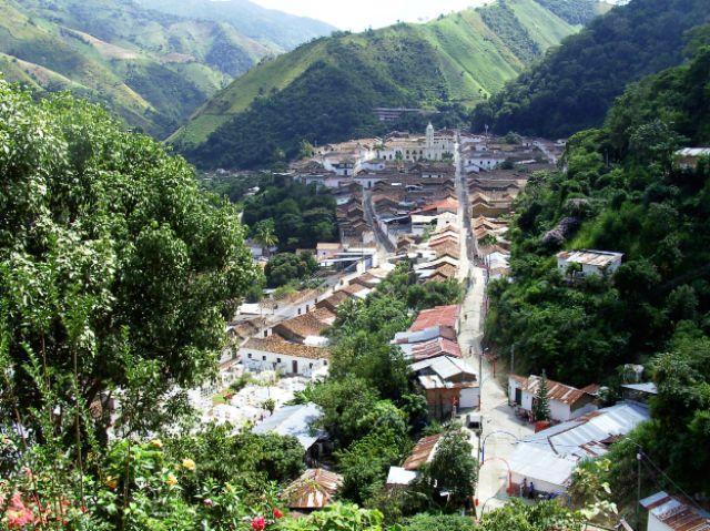
Old Ranch of Our Lady of Carmen


El Carmen, Norte de Santander, Colombia
Suggest Place to Visit
625
Track to location with GPS |
 |
Estancia Vieja de Nuestra Señora del El Carmen, its original name was founded on July 16, 1686, by Lope Bernardo Maris Pedrozo, Francisco González Vega, Francisco Marqués, Nicolás Rodríguez de Mesa, Francisco Quintero Arias and Isabel Fernández de la Torre.
The historian Ciro Castilla Jácome, has argued and supported the founding date of El Carmen, through the document that rests in the National Archive.
On November 7, 1808, he was elected into the parish and the first stone was laid for the construction of the church.
Progress was slow, developing through colonization along the road from Ocaña to Santa Marta. The current population center was formed at the beginning of the 19th century and its existence runs parallel to the founding of the parish.
Among the first settlers of Estancia Vieja, Jerónimo Gómez Farelo and Pérez Casadiego stand out, the first, ancestor of the man of letters Enrique Pardo Farelo, popularly known as Luis Tablanca. Little is known about the population that existed before the arrival of the conquerors. Some chroniclers make mention of the Caretes Indians who lived in the intermediate regions of the Hacaritamas tribes and the jungles of the Motilones.
As an important fact, it is necessary to highlight that at the dawn of this century, approximately in 1916, Colonel Francisco Rivas founded ´´ La Fábrica de Aceites Alianza´´, a castor oil extraction plant that exported its production through the port of Barranquilla to Germany, but due to the development of the First World War and then to the political violence of 1949, its machinery stopped as did the thrust of this prosperous tobacco town.
Full name: Old Ranch of Nuestra Señora del Carmen
Foundation: November 7, 1808
Founders: Lope Fernando Maris, Francisco González Vega, Francisco Márquez, Nicolás Rodríguez de Mesa, Francisco Quintero Arias and Isabel Fernández de la Torre
Population: DANE 2005 Census: 16,377 inhabitants.
Altitude: 761 meters above sea level
Area: 1687 Km2
Climate: Average 23ºC.
Distance to Cúcuta: 313 Km
Geographic coordinates: Longitude west of Greenwich 73º 27´, North Latitude 8º 31´
Limits: North: Republic of Venezuela,
South: Ocaña, González (Department of Cesar),
East: Convention,
West: Department of Cesar.
Western region
Rivers: Quebrada Grande as the main river artery in addition to the El Lorito, La Trinidad, La Osa and Honda streams
Economy:
Agricultural production in lines such as coffee, beans, onion, tomato, corn, cassava, banana.
Livestock production such as bovines.
Mining production: lime and stalactite.
Holidays:
July 16: Virgen del Carmen, patron saint, October 2: Santo Ángel, Patron of Guamalito
Tourist sites:
Edge of the Virgin
Edge of the Cross
Sacred mount
Local pool
La Chamorra, the Waterfall
Monument to Our Lady of Carmen in Guadualito
Pedestal reminder to the chieftain
Liberal Jorge Eliécer Gaitán
Comments
We don´t have yet any comments about:
Old Ranch of Our Lady of Carmen
Old Ranch of Our Lady of Carmen
Be the first to leave a comment as it is very important to inform other people
Outros locais a visitar
Within a radius of 20 km from:Old Ranch of Our Lady of Carmen
Unfortunately we do not have information on other places to visit in this area yet
Hotel reservation near Old Ranch of Our Lady of Carmen within a radius of 20 km
No results
Why to book with TURIS BRASIL
The best prices
Our partnerships with the world´s largest operators offer research on the best market prices.
More options
At Rotas Turisticos you can book the hotel, buy the air ticket, book the transfer from the airport to the hotel and vice versa, book the local excursions, rent the car, take travel insurance and consult the places to visit and where to go.
Holiday Tips & Destinations
Hundreds of holiday destinations with all the options that allow you to easily choose the destination that best suits your dream vacation.
TURIS BRASIL
Links
Follow us on social networks


